Best Zoning and Land Use Monitoring Software
October 29, 2026
The best zoning and land use monitoring software depends on what you need to watch: public meetings, parcel rules, or development scenarios. This shortlist compares tools for South Florida professionals and property owners, with Dais first for Miami-area meeting summaries and address alerts.
1. Dais
Dais reads zoning, planning, and commission meetings across Miami, Miami Beach, Miami-Dade County, and Coral Gables. It turns each meeting into a plain-English summary with member votes and links to the exact minute of the official video. You can browse recent meeting summaries without an account. It’s the clearest fit here for people who need to keep up with public decisions, not just map parcel data.
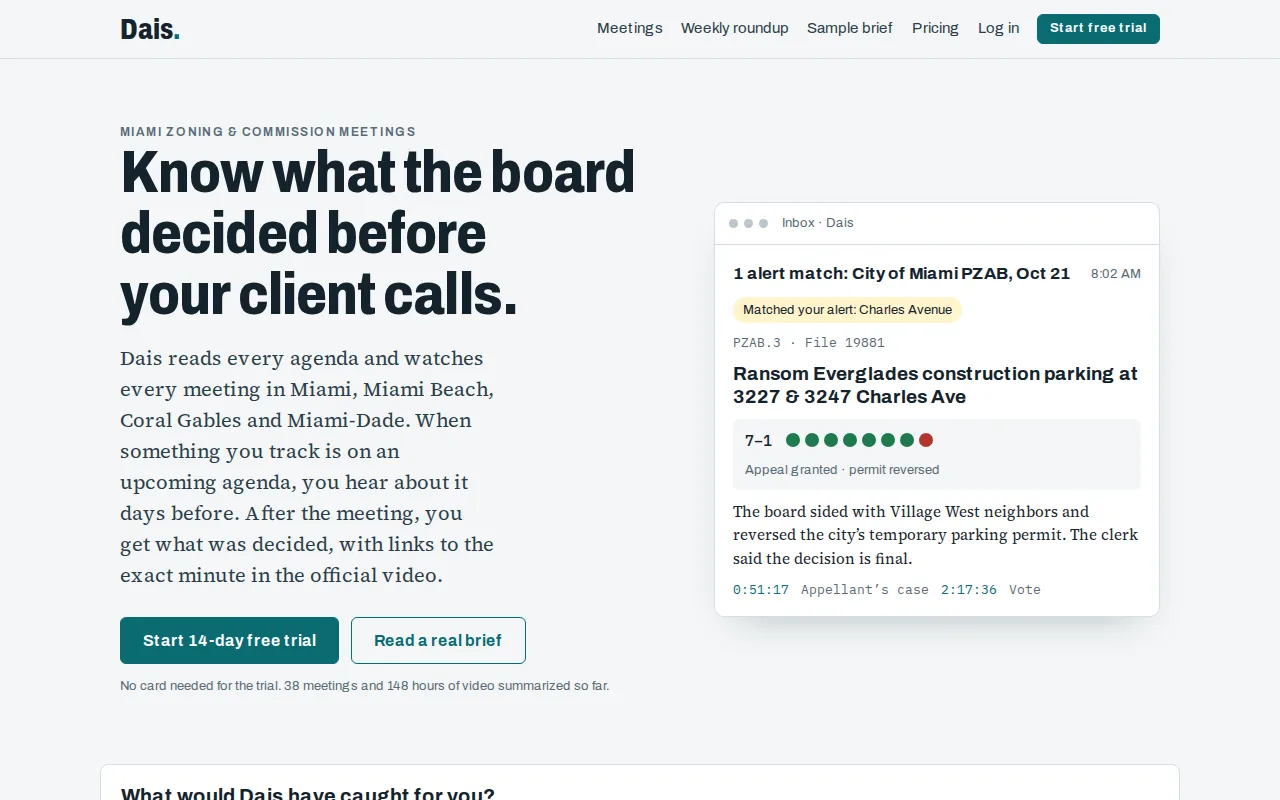
Alerts can track an address, street, person or firm, file number, or anything within a chosen distance of an address. Dais covers 11 boards, including the City of Miami Planning, Zoning and Appeals Board; Miami-Dade Board of County Commissioners; and Coral Gables Planning and Zoning Board and City Commission.
Plans include Neighbor at $19 a month for alerts on up to three addresses, Professional at $199 a month, and Firm at $349 a month for up to five people. A Founding member plan costs $999 a year. Professional, Founding and Firm start with a 14-day free trial, no card needed. Neighbor is paid at signup and can be canceled anytime. Professional and Firm subscribers can share a brief with a client as a read-only link or PDF.
For a broker following a project file or a homeowner near a proposed site, the key value is the meeting record in context. Dais links the summary to the official video moment, so readers can check the source rather than rely on a paraphrase alone. It isn’t a parcel GIS or a zoning capacity model; it tracks local public proceedings and alerts.
2. ArcGIS Urban by Esri: GIS-based zoning and scenario planning
ArcGIS Urban by Esri is a GIS-based option for teams that need to examine zoning rules alongside land-use and development scenarios. It suits planning groups that want a spatial view of potential changes, rather than a meeting alert service.
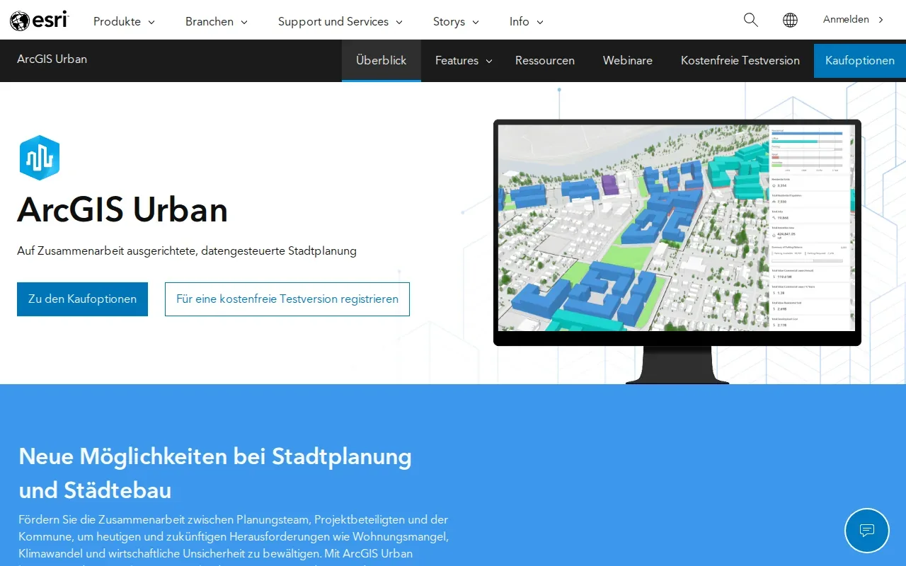
Its zoning work centers on bringing code restrictions into one place. That can help a planning team review how restrictions apply across an area instead of checking each rule in isolation. It also offers 3D visualizations and urban analytics for comparing zoning, land-use, and development scenarios.
That scenario view is useful when staff need to discuss how a proposed change may alter a district’s form. A team could compare two development assumptions in a shared map, then use the output to support an internal planning conversation. The model helps frame the analysis; it doesn’t replace local review of the applicable code or a decision by the relevant public body.
Choose this when spatial modeling and zoning scenario analysis are central to the work. If your immediate need is to know when a South Florida board discusses a particular address, a meeting-monitoring tool is a closer match.
3. QGIS: Open-source GIS for customizable zoning analysis
QGIS is an open-source desktop GIS option for users who want to build a zoning analysis workflow around maps, spatial analysis, and plugins. It’s suited to teams with GIS skills that need control over how they work with spatial data.
It offers map layouts, layered symbology, and spatial analysis tools. Python support through PyQGIS can also enable automation. That gives a technical team room to build repeatable tasks around its own data and analysis needs, rather than relying only on preset workflows.
That flexibility comes with a clear staffing question: someone needs to set up and maintain the project, layers, and any scripts the team uses. A useful first test is to map a small set of parcels, apply the zoning layer, and confirm that the output matches the team’s source data. For ongoing monitoring, teams also need a plan for keeping those inputs current.
QGIS makes sense when a team can manage its GIS workflow and wants a customizable desktop tool. If users need ready-made address alerts or guided zoning reports, assess those needs separately before choosing it.
4. Regrid: Parcel data and mapping APIs
Regrid provides parcel boundaries, property attributes, standardized zoning data, and a parcel API for parcel-focused workflows. It’s a fit for teams that need parcel information as a data layer or as an input to another mapping process.
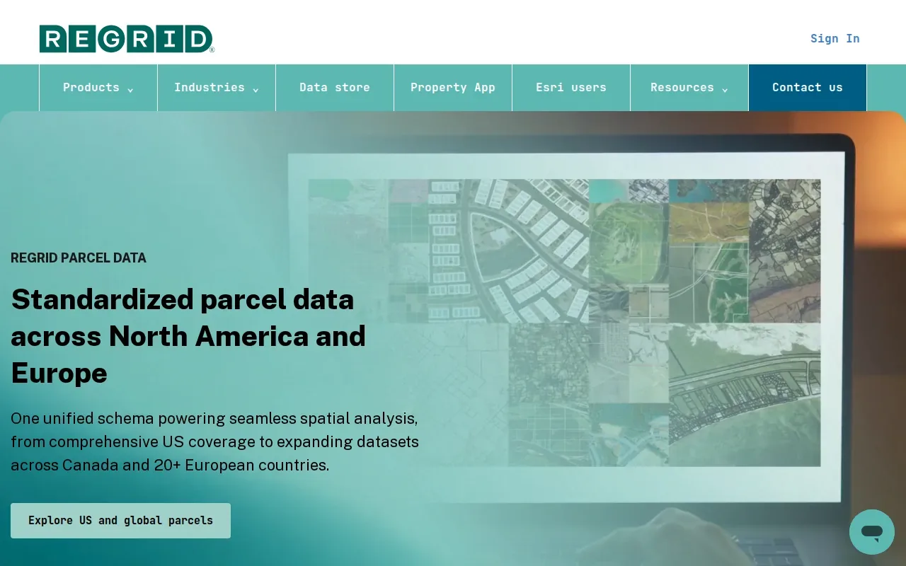
It offers a parcel API and a feature service that brings Regrid parcel data into ArcGIS. That can matter when a team wants parcel data to feed a map or another workflow, rather than treating each parcel lookup as a separate manual task. A GIS analyst could use parcel boundaries as the base layer, then connect relevant property attributes to the team’s work.
Parcel data doesn’t answer every zoning question by itself. Users still need to check the applicable zoning rules and any local overlays that affect the site. The refresh timing and completeness of parcel records also matter to a team’s process, so define how the data will be checked before relying on it in a due diligence record.
Consider Regrid when parcel data and mapping APIs are the main need. It can support a GIS-centered workflow, while Dais is designed for monitoring public meeting records and sending alerts around selected addresses or other search terms.
5. Zoneomics: Zoning constraints and permitted-use site search
Zoneomics offers AI-driven zoning analysis and site search. Users can filter properties in a region by zoning, permitted land uses, and lot width and height. It’s aimed at users who are screening sites and need zoning-related information to narrow their search.
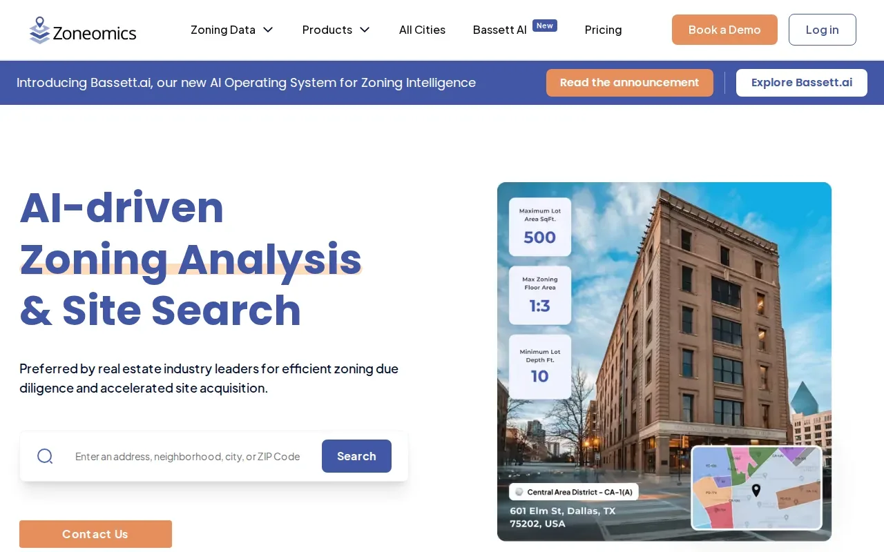
That search focus can help an acquisition or development team sort potential locations before spending time on a detailed review. A user can start with a permitted-use question, then examine candidate parcels and the constraints flagged for them. Zoneomics also offers a zoning API for single properties or bulk data.
Automated flags can make a first pass easier, but they shouldn’t be treated as a legal determination or a guarantee of project approval. Verify a candidate against the relevant local sources and confirm that the parcel data and zoning rules apply to the exact site. That check is especially important when a project crosses jurisdictions or depends on a specific use condition.
Zoneomics is a match for cross-jurisdiction site search and zoning constraint screening. If your priority is following a local board’s discussion of a pending project, meeting summaries and alerts answer a different question.
Compare zoning and land use monitoring software
These tools address different stages of land-use work. The best zoning and land use monitoring software for a homeowner tracking a nearby hearing may be a poor fit for an analyst building capacity scenarios. Compare each option against the work your team repeats most often.
| Tool | Best match | Core workflow | What to verify |
|---|---|---|---|
| Dais | South Florida meeting and address monitoring | Plain-English meeting summaries, vote records, video-minute links, and alerts | Confirm the boards and alert terms that fit your matter |
| ArcGIS Urban by Esri | Zoning and development scenarios | Centralized code restrictions with 3D scenario analysis | Check how your zoning data and assumptions enter the model |
| QGIS | Custom GIS analysis | Desktop maps, spatial analysis, plugins, and PyQGIS automation | Plan who maintains layers and scripts |
| Regrid | Parcel data workflows | Parcel boundaries, attributes, standardized zoning, and a parcel API | Check data fit and refresh needs |
| Zoneomics | Permitted-use site search | Zoning and permitted-use filters, site search, and a zoning API | Confirm findings against local zoning sources |
For South Florida users tracking public decisions, Dais is the most direct match in this group. For spatial analysis, capacity work, or parcel screening, select the tool that aligns with the data and outputs your team needs. Some organizations may use more than one type of tool, but they should define which record is authoritative for each task.
What to check before choosing zoning monitoring software
Start with the decision you need the software to support. Is it a board agenda alert, a parcel zoning check, a capacity scenario, or a development review record? A crisp answer helps you compare tools on what they actually do, rather than on broad feature labels.
Then check the data path. Ask where parcel boundaries and zoning layers come from, how often your team must refresh them, and whether the workflow connects to the GIS or records tools you already use. API support can help move data between systems, but it doesn’t remove the need to check how the information is maintained.
Look at the output as closely as the map. Can staff see the source behind a zoning result? Can a reviewer save the date and assumptions behind a scenario? For any system that generates a report or flag, make sure a person can check the relevant source record before relying on the result.
Finally, test the day-to-day fit. Consider who will maintain layers or rules, whether users need desktop or browser access, and how alerts reach the people responsible for follow-up. For a small team, a free trial can be a useful way to test one live task before paying. Dais has a 14-day trial with no card needed.
Frequently asked questions
What does zoning and land use monitoring software do?
Zoning and land use monitoring software helps users review land rules, parcel data, development scenarios, or public proceedings. The exact job depends on the product. GIS tools map zoning layers, site-search tools screen parcels, and meeting-monitoring tools track public discussion. Before choosing one, name the record or alert you need to act on.
Which tool is best for tracking Miami zoning meetings?
Dais is the most direct fit in this shortlist for Miami-area zoning meeting monitoring. It summarizes meetings across Miami, Miami Beach, Miami-Dade County, and Coral Gables, with votes and links to the exact minute of the official video. It also lets users set alerts for addresses and other selected terms.
Can zoning software tell me if a project will be approved?
No software result should be treated as a promise that a project will be approved. A zoning map, automated flag, or scenario model can support research, but the applicable local rules and review process still matter. Check the source record and seek qualified local guidance when you need advice about a specific property or proposal.
What should a developer look for in a zoning tool?
A developer should start with the work at hand: parcel screening, code verification, capacity analysis, or public meeting tracking. Then test the data sources, map or report output, and workflow fit with a real site. If a tool generates a result, ask how staff can verify the source and save the assumptions behind it.
Does zoning software replace GIS staff or local review?
No. GIS software can support mapping and spatial analysis, while other tools can organize parcel research or meeting records. People still need to maintain data, check applicable rules, and review results. For a decision tied to one property, verify the relevant local records rather than relying on a map layer or automated output alone.
Conclusion
For South Florida professionals and homeowners who need to follow local zoning discussions, Dais is the clearest place to start. Get an email when something is filed near an address you care about: try Dais free for 14 days at https://dais.webblaze.io.